Documentation & data
Aerial mapping and site measurement
One current, high-resolution, top-down view of the whole site - stitched from hundreds of overlapping aerial images - with reference measurements for documentation, visualization and planning.
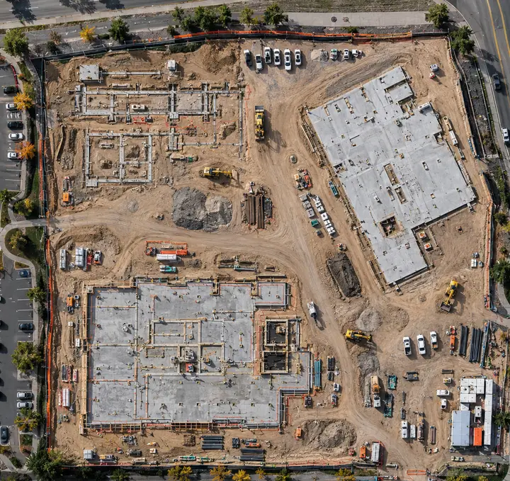 Example
In short
AerialIQ flies overlapping aerial imagery and processes it into orthomosaic maps - one current, top-down image of the whole site - with reference measurements for documentation, visualization and planning. It is not a licensed land survey and does not replace one.
Capture and delivery
What AerialIQ captures, and what you receive
Captured on site
- Overlapping imagery flown on a planned grid at a consistent altitude
- Complete coverage of the site to its edges, not just the middle
- Oblique passes where elevation or structures need more than a top-down view
- Ground reference points where the scope calls for them
- The same flight plan re-flown on later visits, for recurring maps
What you receive
- Orthomosaic map
- A single georeferenced, high-resolution image of the whole site, in standard formats for GIS and CAD viewers.
- Site overview images
- Oblique aerial photographs that make the map easy to read for people who do not read maps.
- Reference measurements
- Distances and areas marked on the map, labelled as approximate and for reference.
- Elevation visualization (optional)
- A shaded surface model that shows relative height across the site.
- Stockpile estimates (optional)
- Approximate material volumes, where the site and the capture support a meaningful estimate.
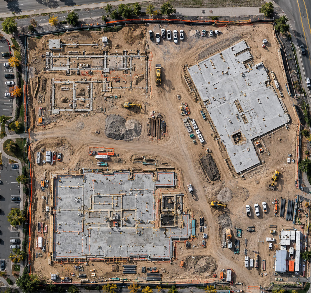 Example
Who it is for
Common project situations
Typically contractors and developers, property and facility managers, land and ranch owners, aggregate and material yards, municipalities and public works and architects and planners.
Planning and pre-construction
A current picture of the whole site for design conversations, before anything is disturbed.
Progress, month over month
The same map re-flown on a schedule, so change across a large site is visible in one image.
Stockpiles and yards
Approximate material volumes for inventory conversations, from the same capture every time.
Land and large properties
Acreage that is impossible to see from the ground - roads, water, structures and drainage - in one view.
The whole site, at once
What an orthomosaic shows
Hundreds of overlapping photographs, corrected for perspective and stitched into one image of the whole site at a consistent scale - current to the day it was flown.
Current
Flown on the day, not a satellite image from last year.
Detailed
Far higher resolution than public aerial imagery - vehicles, materials and markings are legible.
Complete
The whole site to its edges in one image, not a handful of angles.
Repeatable
The same flight plan re-flown on a schedule produces maps that line up.
Where mapping stops
Reference measurements, not a land survey
Aerial mapping is extremely useful for documentation, visualization and planning. It is not licensed land surveying, and the line is stated plainly so nobody relies on it for something it cannot do.
AerialIQ provides
- Current, high-resolution orthomosaic maps
- Reference distance and area measurements
- Elevation visualization across the site
- Approximate stockpile volumes where the capture supports them
- Maps re-flown on a schedule for comparison
AerialIQ does not provide
- Licensed land or boundary surveys
- Legal descriptions or property-line determinations
- Construction staking or design-grade topography
- Engineering conclusions of any kind
- Certified quantities or guaranteed accuracy
Pricing guidance
How much does aerial mapping cost?
Pricing
Quoted per project
Starting figures are guidance, not a quote. The final price is confirmed in writing once the scope, location and deliverables are known.
What moves the final quote
- Project scope and the size of the site
- Location and travel from northern Colorado
- Complexity - access, airspace, obstructions, timing windows
- The deliverables required, and how much editing they involve
- Flight requirements such as number of viewpoints or passes
- Recurring work, priced per visit below the one-off rate, with a lower rate again for prepaid terms
Questions
Frequently asked questions
What is an orthomosaic?
A map-like aerial image built by stitching hundreds of overlapping photographs and correcting them for perspective, so the whole site appears as if seen from directly above at a consistent scale. It is far more current and detailed than satellite imagery.
Is this a land survey?
No. AerialIQ is not a licensed land surveyor and does not provide boundary surveys, legal descriptions, construction staking or engineering design data. Aerial maps and reference measurements are for documentation, visualization and planning. Where a licensed survey is required, AerialIQ imagery can give the surveyor context but does not replace their work.
How accurate are the measurements?
They are reference measurements and are approximate. Accuracy depends on altitude, image overlap, terrain and whether ground reference points are used, so the quote states the method and what the measurements are suitable for. They are not for boundaries, legal or engineering decisions.
Can you measure stockpile volumes?
Approximate volumes can be estimated where the site and the capture support it - clear stockpile edges, a visible base and suitable coverage. They are estimates for inventory conversations, not certified quantities.
What file formats do I receive?
Standard formats that open in common GIS, CAD and image software, plus plain images anyone can view. The exact formats are agreed in the quote so they match the software your team uses.
How much does aerial mapping cost?
Each project is quoted individually. Site acreage, terrain, the level of detail required, measurement and elevation products, and travel affect the final figure, which is confirmed in writing in the quote.
Can AerialIQ travel to my site?
Yes. Projects throughout Colorado, from a base in northern Colorado. Travel is estimated from the project location and itemised in the quote, so the price reflects where the site actually is.
Next step
Ready to talk about a project?
Send the location, what you need captured and roughly when. That is enough to come back with a scope and a price.