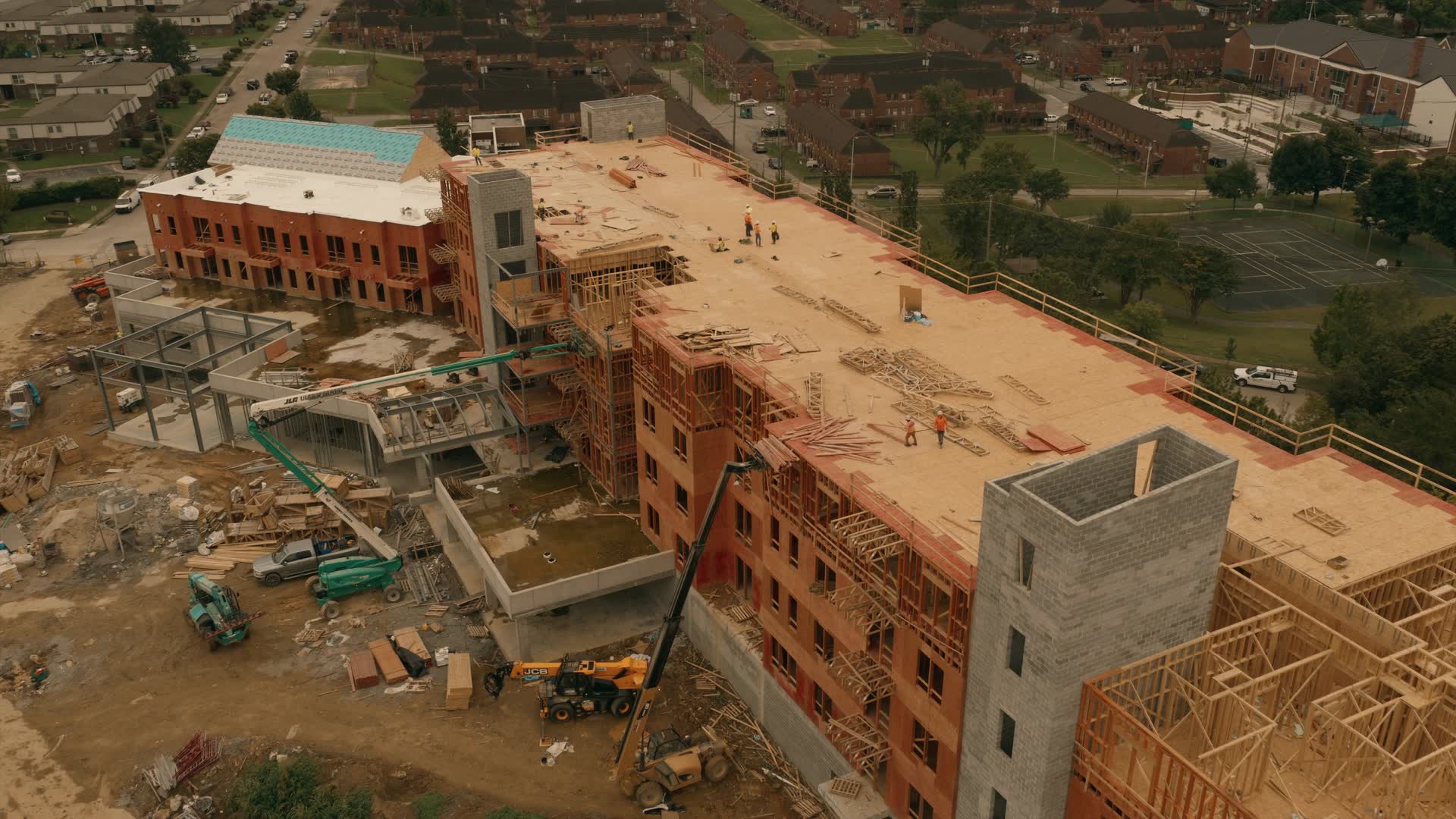
Aerial documentation built for real projects
Drone documentation for Colorado construction sites, properties and buildings.
Progress photos from the same positions every visit, orthomosaic site maps, roof and facade inspection imagery, 3D models and aerial video - planned, captured and delivered as organised sets, once or on a schedule.
Illustrative stock imagery
Same viewpoints, every visit
Recorded positions and altitudes, so month seven lines up with month one.
How monitoring worksPlanned before anyone drives out
Airspace, site access and the forecast are checked first.
How it worksOrganised deliverables
Labelled sets you can use, not a folder of raw files.
What you receive
Services
What do you need?
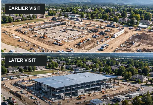 ExampleConstruction DocumentationTrack project progress over time.From$325 / visit
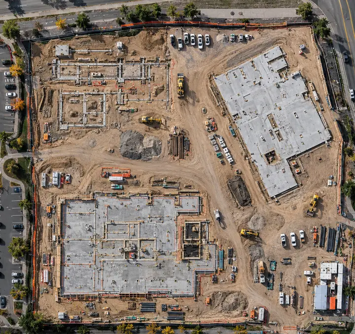 ExampleMapping & OrthomosaicsSee the entire site in one high-resolution view.Quoted per project
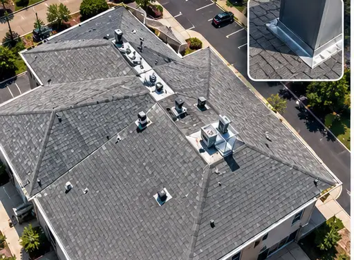 ExampleInspection ImageryGet detailed visual access to difficult areas.From$275 / property
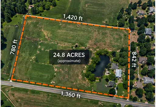 ExampleProperty & Land DocumentationDocument land, structures and infrastructure.Quoted per project
Recurring monitoring
Need eyes on it every month?
Define what matters once. AerialIQ returns on schedule and captures the same locations, viewpoints and conditions every visit - weekly, monthly, quarterly or seasonally.
- Construction monitoring
- Commercial property monitoring
- Property & land monitoring
- Contractor portfolio monitoring
- Public works documentation
Month 01
Baseline
Month 02
Same viewpoint
Month 03
Change is visible
What you receive
Imagery built to answer a question.
Not a folder of drone photos. Each deliverable is planned around what you need to know about the site.
Is it really the same view every month?
Drag, or use the arrow keys, to compare
Saved viewpoints, flown identically each visit, so two captures months apart line up.
Construction documentationCan I see the whole site at once?
An orthomosaic map: one current, high-resolution view, with reference distances and areas.
Mapping & orthomosaicsCan I see the detail without a ladder?
The wide frame shows where you are; the full-resolution detail shows what is there.
Inspection imageryDeliverables include
- Photo sets
- Orthomosaic maps
- Reference measurements
- Inspection imagery
- 3D models
- Video
- An organised archive
These are drawings, not client work. Real project imagery is shown here once a client approves it.
How it works
From first message to organised deliverables.
- 1
Scope
The site, what needs capturing, the deliverables, and whether it is once or on a schedule.
- 2
Plan
Airspace, authorizations, access and weather are checked before anyone drives out.
- 3
Capture
Flown under FAA Part 107 rules, from planned positions.
- 4
Process
Imagery is edited, stitched into maps or built into models - whatever the scope calls for.
- 5
Deliver
Organised, labelled deliverables, not a folder of raw files.
Repeat on schedule. For recurring work, the same scope is captured again from the same viewpoints, so every visit compares with the last.
How AerialIQ operates
Judge it on the method.
AerialIQ is run by Cody Bennett, founder. It is a specialist operation, early, and there is no point pretending otherwise with borrowed credibility. What can be stated plainly is how the work is done and where it stops.
Every flight
Flown under FAA Part 107
Commercial drone work in the US is flown under the FAA's Part 107 rules, with a certificated remote pilot in command who has the final say on whether a flight is safe. AerialIQ works within those rules on every flight.
Before the visit
Airspace, access and weather are checked first
Controlled airspace, site access and the forecast are resolved before anyone drives out, because a wasted trip is your schedule as well as ours.
Every capture
Recorded positions, not approximate ones
Recurring work is flown from saved viewpoints with a fixed altitude and heading, which is what makes two visits months apart genuinely comparable.
What we do not do
Documentation, not professional conclusions
AerialIQ supplies imagery and visual documentation. It does not provide engineering inspections, land surveying, structural assessment or insurance adjusting - those stay with your licensed professional.
Before you get in touch
What happens when I get in touch?
You describe the site, the scope and roughly when you need it. We confirm the airspace, access and weather picture, then come back with what is possible and what it costs. No sales call is required to get that.
What can I actually request?
A single visit, a defined project, or recurring monitoring on a cadence you set. Construction documentation, mapping, inspection imagery, property and land records, 3D models and aerial media all start the same way.
Where does AerialIQ work?
Projects throughout Colorado, from a base in northern Colorado. Travel is estimated from the project location and itemised in the quote, so the price reflects where the site actually is.
What is the next step?
Send the project details. If it is a fit you get a scope and a price; if it is not, you get told that instead of being chased.
More questions answered - cost, delivery, surveys, schedules
Start a project
Tell us about the site and the timing.
Location, what you need documented, and roughly when. That is enough to come back with a scope and a price.
Service area
Projects throughout Colorado, from a base in northern Colorado. Travel is estimated from the project location and itemised in the quote, so the price reflects where the site actually is.
Looking for examples?
Case studies are published as clients approve them. In the meantime, each service page shows a labelled example of what the deliverable looks like.